UNIVERSITY OF WISCONSIN River Falls
Genealogy
Maps
For all types of maps, check the UWRF online library catalog for any recent additions. Also check the catalog for maps contained within manuscripts or government records collections, and in books, that do not easily fit into one of the categories below. Check the catalog, too, for the Library's Government Documents collection, which contains many types of maps, including the USGS topographical maps collection.
Bird's-Eye View Maps
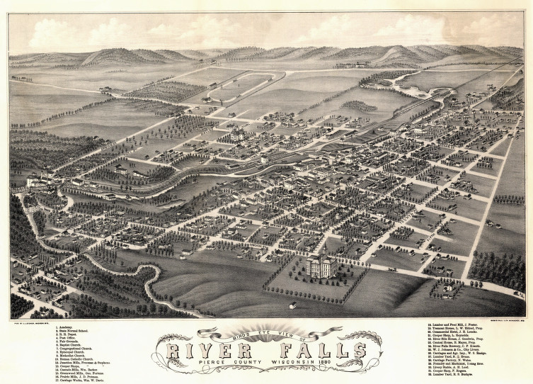
The bird's-eye view, panoramic, perspective, or aero view map was a popular cartographic form in the late nineteenth and early twentieth centuries. They depict an aerial view of entire cities or villages. They were not drawn to scale so the perspective is distorted, but they do show street patterns, individual buildings, and major landscape features.
The only bird's-eye view map that the Archives has is the 1880 bird's-eye view of River Falls (image to the right). There was also an 1870 bird's-eye view map of Hudson, but we only have a reproduction copy.
Learn more about bird's-eye view maps on the Wisconsin Historical Society's website. The Library of Congress website has information on birds-eye view maps for the entire country.
City Maps
While older city maps tend to be fire insurance maps or from plat books, most modern city maps that the Archives has tend to be promotional maps, published by a chamber of commerce or a newspaper.
This list is a work in progress.
City |
Years Available in the UWRF Archives |
|---|---|
|
Hudson |
1995, 2008, 2010 |
|
River Falls |
1994, 1996, 2000, 2004, 2006, 2008, 2010 |
County Maps
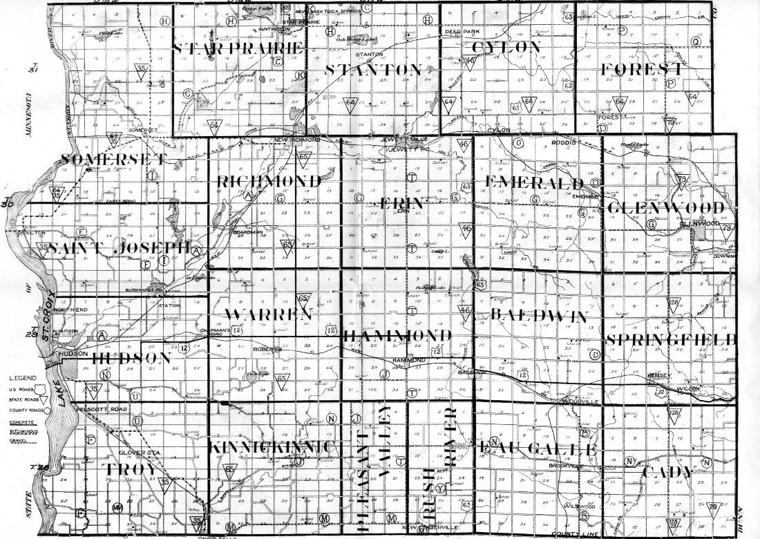
This section is a work in progress. It will contain maps for the ARC's four counties (Burnett, Pierce, Polk, and Saint Croix), such as State Highway Commission county maps, promotional maps, and maps created for various other purposes.
Saint Croix County, 1938
For older maps of counties, see also the Land Ownership Maps.
County |
Years Available in the UWRF Archives
|
|---|---|
|
Burnett |
1953, 1954, 1959, 1978, 2008, 2012 |
|
Pierce |
1954, 1996, 2007, 2008, 2009 |
|
Polk |
1938, 1975 |
|
Saint Croix |
1886, 1938, 1947, 1953, 1962, 1996, 2007, 2008, 2009, 2010 |
Fire Insurance Maps
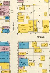
Fire insurance maps were created to assist insurance agents in determining the degree of fire hazard associated with a particular property. They are large, detailed, color-keyed, building-level maps of select cities and villages. The most widely-known company—and the majority of our maps—was the Sanborn Fire Insurance Company. They updated their maps every decade or so, which allows researchers to see, for example, the development of the business district, additions being made to residences, or the deletion of outbuildings.
Learn more about Sanborn Fire Insurance Maps on the Wisconsin Historical Society's website. They have digitized all pre-1923 Wisconsin Sanborn maps.
Portion of Sanborn map for Osceola, 1926
County |
City |
Years Available in the UWRF Archives
|
|---|---|---|
|
Burnett |
Grantsburg |
1894, 1902, 1916, 1931 |
|
Pierce |
Ellsworth |
1894, 1900, 1912, 1927, 1927 base map updated to 1940 |
|
Prescott |
1884, 1892, 1898, 1902, 1912 |
|
|
River Falls |
1884, 1891, 1900, 1912, 1927, 1927 base map updated to 1935 |
|
|
Spring Valley |
1900, 1912, 1931 |
|
|
Polk |
Amery |
1911, 1926, 1926 base map updated to 1938 |
|
Frederic |
1911, 1926 |
|
|
Osceola |
1911, 1926 |
|
|
Saint Croix Falls |
1885, 1892, 1899, 1917, 1926, 1926 base map updated to 1935 |
|
|
Saint Croix |
Baldwin |
1902, 1912, 1930 |
|
Glenwood City |
1893, 1900, 1912, 1930 |
|
|
Hammond |
1895, 1902, 1930 |
|
|
Hudson |
1884, 1891, 1900, 1912, 1924, 1924 base map updated to 1945 |
|
|
New Richmond |
1887, 1892, 1900, 1912, 1927, 1927 base map updated to 1943 |
|
|
River Falls |
1884, 1891, 1900, 1912, 1927, 1927 base map updated to 1935 |
|
|
Wilson |
1925 |
Land Ownership (Plat) Maps
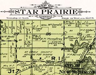
Wisconsin land ownership maps and atlases—often referred to as plat maps—identify local landowners in a county and provide information about the county's topographic and cultural features. Township maps show the boundaries and acreage of farms, locations of churches, cemeteries, schools, quarries, cheese factories, and other businesses. The township maps also show roads and railways, and topographical features such as rivers, lakes, marshlands, and hills. Click on map for larger view
Learn more about land ownership maps on the Wisconsin Historical Society's website.
County |
Years Available in the UWRF Archives |
|---|---|
|
Burnett |
1915, 1930, 1931, 1948, 1962, 1965, 1974, 1976, 1981, 1983, 1991, 1997, 2006, 2010 |
|
Pierce |
1877-1878, 1895, 1908, 1917, 1922, 1930, 1941, 1949, 1955, 1959, 1960, 1965, 1968, 1971, 1973, 1975, 1978, 1981, 1984, 1989, 1992, 1999, 2006, 2010, 2013 |
|
Polk |
1887, 1914, 1924, 1931, ca. 1940, 1950, 1962, 1966, 1969, 1972, 1980, 1986, 1989, 1992, 1996, 2000, 2007, 2010 |
|
Saint Croix |
1876, 1886, 1897*, 1914, 1925, 1929, 1938, 1949, 1956, 1959, 1961, 1965, 1968, 1972, 1974, 1976, 1979, 1982, 1985, 1987, 1988, 1991, 1993, 2005, 2008, 2010 |
* For digital copies of Baldwin (Town of and Village of), Hammond, and Woodville only from the 1897 plat book, see the University of Wisconsin Digital Collections. Use the Search Box; a search for "Baldwin maps 1897" will find all of them. Additionally, there is a plat map of the Village of Baldwin only, ca. 1890-1899, which you can find by searching "Baldwin maps 1890." (The River Falls ARC does not have a copy of this last map.)
We also have a few plat map books for neighboring counties:
County |
Years Available in the UWRF Archives |
|---|---|
|
Barron |
2008, 2012 |
|
Dunn |
1888, 1927, 2008, 2011, 2013 |
|
Pepin |
1877, 2003, 2008, 2012 |
Rusk | 2007 |
|
Washburn |
2008, 2012 |
Resort/Tourist/Trail Maps
Tourism is, and has been, big business in northwest Wisconsin. Maps showing the resorts, lakes, fishing, and various kinds of trails were common for counties and larger areas to produce.
Area |
Years Available in the UWRF Archives
|
|---|---|
|
Burnett County |
1950s (resorts), 1970s (resorts) |
Crex Meadows Wildlife Area | 1960s, 2003 |
Danbury Area | 1947 (resorts) |
Grantsburg Area | 1960s (resorts) |
|
Indianhead Country |
ca.1939 |
Interstate Park (St. Croix Falls) | 20?? (Hiking trails) |
Northwest Wisconsin | 2014 (ATV & UTV trails) |
Osceola | 2015 (trails) |
Polk County | 2015-16 (snowmobile & ATV trails) |
Trade River | 2010 (equestrian trail) |
Soil Surveys and Maps
A county soil survey includes a brief overview of the county's geography, plus a soil map with a brief description of each of the major soil types found in the county.
County |
Years Available in the UWRF Archives
|
|---|---|
|
Burnett |
2006* |
|
Pierce |
1930, 1968, 2006* |
|
Polk |
1979* |
|
Saint Croix |
1978* |
* For digitized copies of these years, see the United States Department of Agriculture's soil surveys for Wisconsin on the USDA's Natural Resources Conservation Service website.


