UNIVERSITY OF WISCONSIN River Falls


Archives Resources
Kinnickinnic River
Disclaimer:
This webpage does not purport to include everything there is about the Kinnickinnic -- river and valley. Following are examples of what is available to help you learn more about the Kinni and provide leads you can follow to do more research.
Short History of the Kinni
The River Falls Municipal Utility owns and operates two dams as a hydroelectric project licensed by the Federal Energy Regulatory Commission. The current license expires August 31, 2018.
Archival Materials
The following collections may be of use in researching aspects of the Kinnickinnic River.
- Electric and Water Department of River Falls, Wisconsin. Records, 1916-1953. Includes correspondence, specification volumes, accepted bids, blueprints, and balance sheets relating to construction and expansion of the power plant, water main, and the pumping plant, and to their operation (1921-1953).
Available at the University Archives and Area Research Center, Pierce Series 60 - Engineer of River Falls, Wisconsin. Records, 1894-1948. Includes plans, specifications, blueprints, and correspondence relating to city engineering projects, including bridges, sewers, sewage treatment, and other projects.
Available at the University Archives and Area Research Center, Pierce Series 59 - River Falls Improvement League. Records, 1900-1916. Includes Constitution, minutes, and miscellaneous records of the Improvement League, an organization of River Falls women who campaigned for sidewalk repairs, weed control, the creation of parks, and other projects for community beautification and betterment. Included are registers for the public rest room for women which the league established.
Available at the University Archives and Area Research Center, River Falls Mss W; Finding Aid available online - River Falls (Wis. : City) Clerk. Clerk's Papers, 1886-1957. Papers consisting mainly of applications, general correspondence, petitions, records of poor relief, reports of city officials, and tax statements.
Available at the University Archives and Area Research Center, Pierce Series 124. Finding Aid available online - River Falls (Wis. : Town) Clerk. Clerk's Papers, 1879-1975. Minutes of town and board meetings, election results, register of town and school officers, oaths of office, financial records of the highway districts, minutes of the board of review, registers of orders drawn on the town treasurer, licenses issued, and reports of the board of audit.
Available at the University Archives and Area Research Center, Pierce Series 142. - Various collections of reminiscences/recollections/memoirs could contain relevant information, but have not been cataloged with subject headings that allow us to find them. You would need to read the documents to know.
Printed Resources
-
History of the Kinnickinnic River valley / by Philip J. Foster. M.S. thesis, University of Wisconsin-River Falls, 1974.
Available at University Archives and Area Research Center Archives Reference Room (Call Number: F 587 .P6 F67 1974)
Available at Chalmer Davee Library Main Collections (Call Number: LD 6096 .R57 F675)-
History of the Kinnickinnic River Valley was published in 1974 as Volume 4 of "Pierce County Heritage" ; Pierce County Historical Association, 1974.
Available at University Archives and Area Research Center Archives Closed Stacks (Call Number: F587.P6 P5)
Available at Chalmer Davee Library Main Collection (Call Number: F587.P6 P5)
-
-
Management alternatives for the Lower Kinnickinnic River Valley / by Stephen F. McCool and Albert J. Beaver. (River Falls, Wis. : University of Wisconsin-River Falls, 1972). Available at University Archives and Area Research Center Archives Reference Room (Call Number: TC424.W6 M33 1972)
-
Nonpoint source control plan for the Kinnickinnic River Priority Watershed Project / the Wisconsin Nonpoint Source Water Pollution Abatement Program ; cooperatively prepared by the Wisconsin Department of Natural Resources [and] the Kinnickinnic River Priority Watershed Citizens Advisory Committee. Wisconsin Nonpoint Source Water Pollution Abatement Program. Wisconsin. Bureau of Water Resources Management. Nonpoint Source and Land Management Section.; Kinnickinnic River Priority Watershed Citizens Advisory Committee, 1994, and 1999.
Available at Chalmer Davee Library Government Documents Wisconsin (Call Number: ENV.1/6:K 558/1994 and ENV.1/6:K 558/1999)
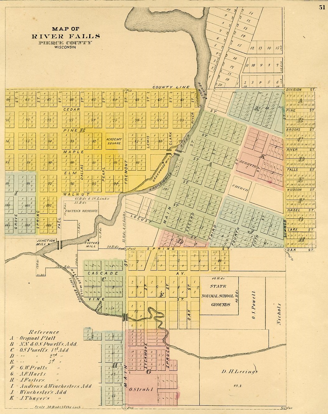
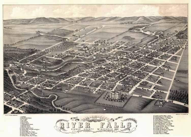
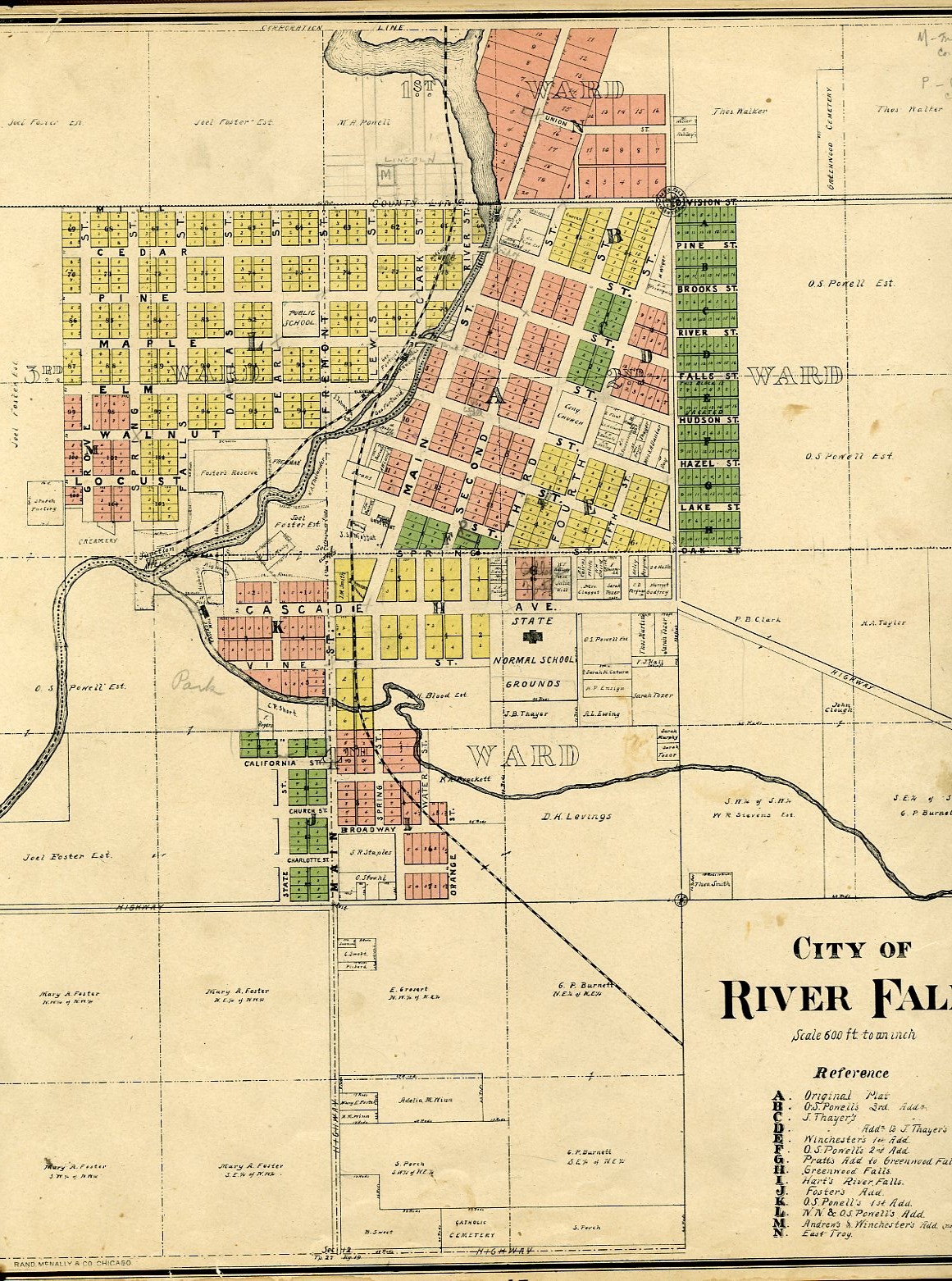
Maps
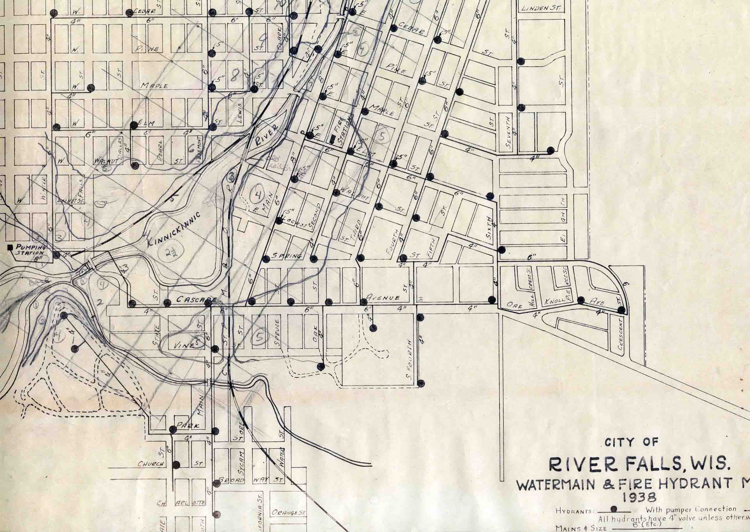
- "A. A. Freeman Flouring Mills, River Falls, Wis." ; Western Fire Map Pub. Co., n.d. [Map showing the Kinnickinnick River, the Mill Dam, the Iron Bridge, the rail road track, and Freeman's buildings.]
- Atlas/plat book of Pierce County (various names), 1877-78, 1895, 1908, 1917, 1920(?), 1922(?), ca.1926-34, 1930, 1941, 1949, 1959, 1960, 1965, 1968, 1971, 1973, 1975, 1977, 1978, 1981, 1984, 1989, 1992, 1999, 2003, 2006, 2008, 2010.
- "The Big Flood" ; River Falls Journal, May 13, 1976. [Map published in the River Falls newspaper showing "the large area in the city of River Falls that has been declared a flood plain or is in the process of being declared a flood plain." The maps shows the South Fork of the Kinnickinnic at the bottom of the map, and a small portion of the Kinnickinnic River at the upper left. The map is the size of a full newspaper page.]
- "City of River Falls, Pierce & St. Croix Counties, Wisconsin" ; River Falls Chamber of Commerce, ca. 1981-84. [Map labels Lake George, Lake Louise/Luise is labeled merely as "Kinnickinnic River," also labeled is the White Pathway.]
- "Edward T. (Ned) Fagan, Candidate for Municipal Justice of the Peace, City of River Falls" ; April 3, '79. [Map showing the location of the city wards and where to vote; also shown is the Kinnickinnic River and the lakes.]
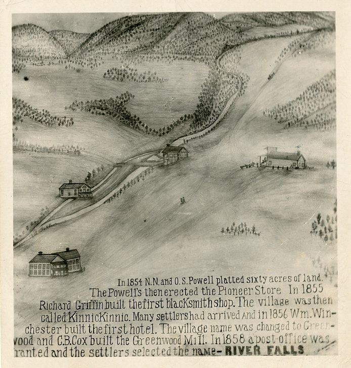
- Hand-drawn map of the settlement that became River Falls, from 1858, showing the Kinnickinnic and four buildings along the river.
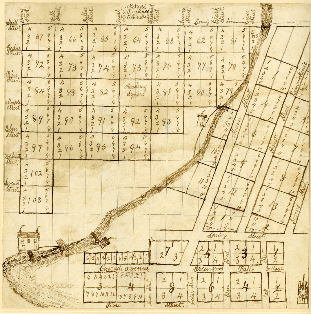
- Hand-drawn plat of River Falls from 1870, showing the Kinnickinnic flowing through town with the locations of multiple dams.
- "Hiking - Cross Country Ski Trails" ; City of River Falls Park Board and Chamber of Commerce, [ca.1977].
- "Kinnickinnic River Watershed" / Hal Watson, cartographer ; Kinnickinnic River Land Trust, 2002.
Available at University Archives and Area Research Center Archives Closed Stacks (Call Number: GB705.W6 K56) - "Kinnickinnic Watershed Public Recreation Map" / cartography and design: Charles Rader with Eric Forward and Erica Rader ; Kinnickinnic River Land Trust (Wis.), 2014.
Available at Chalmer Davee Library Government Documents Maps and Posters (Call Number: GB705.W6 K56 2014)
Available at University Archives and Area Research Center Archives Closed Stacks (Call Number: GB705.W6 K56 2014) - "River Falls, Wisconsin, 2015-2016" ; River Falls Journal ; River Falls Chamber of Commerce and Tourism Bureau, c2015.
- "River Falls Municipal Power Plant" ; [publisher not identified], 1972.
Available at University Archives and Area Research Center Archives Closed Stacks (Call Number: G4124 .R8N3 1972 .R8) - Sanborn Fire Insurance Company Maps for River Falls (photocopies), 1880, 1884, 1891, 1900, 1912, 1927.


Photographs, Film, Video
x
General Photographs of the Kinni


Flooding


Glen Park

Mills
")


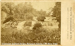
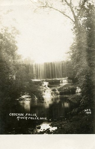
Waterfalls
Cascade Falls


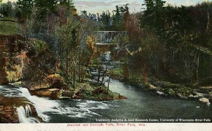
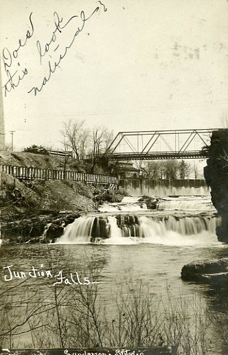
Junction Falls


Power Plants


Contact Us
University Archives and Area Research Center
170 Chalmer Davee Library
(715) 425-3567
archives@uwrf.edu

![]()


