UNIVERSITY OF WISCONSIN River Falls
Genealogy
Land Records
Court Records
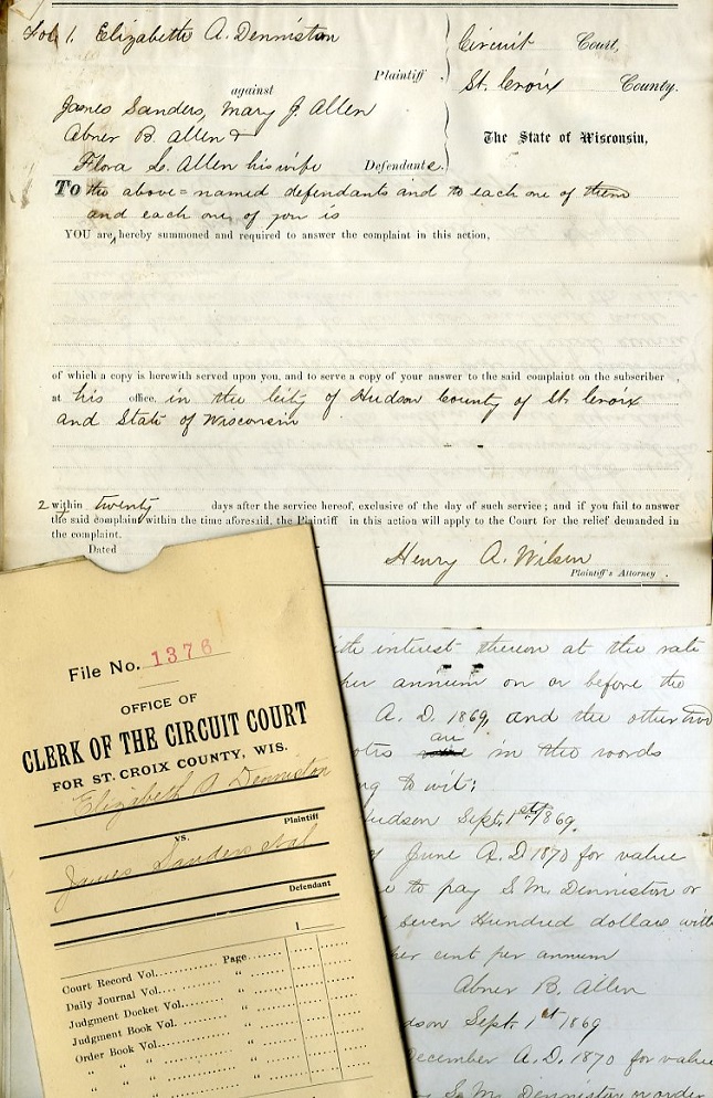
Many types of court records can contain information about land. For example, civil case files include disputes about land; probate files include transfer of ownership information after a death.
- Burnett County
- Civil Case Files,1888-1971
- Probate Files,
- Pierce County
- Civil Case Files, ca. 1866-1930
- Polk County
- Homestead and Land Entry Records, 1865-1914 (Polk Series 23)
- Probate Files, 1855-1941
- Records of State Lands in Polk County, 1859-1917 (Polk Series 27)
- Saint Croix County
- Civil Case Files 1850-1928
- Judgment Book of Foreclosure and Sale, 1860-1920 (St. Croix Series 123)
County Government Records
Records created by county government entities include the County clerk, treasurer, town assessors. The UWRF Archives does not have any title records of the Register of Deeds offices; please see the county courthouse in the county you are interested.
- Burnett County
- Real Estate Sales Reports, 1908-1911 (County Clerk, Burnett Series 5)
- Tax Sale Book, 1866-1874 (County Treasurer, Burnett Series 9)
- Pierce County
- Abstracts of Tax Sales, 1856-1871 (County Treasurer, Pierce Series 99)
- Real Estate Assessor's Field Book, 1946-47 (Town of Clifton, Pierce Series 39)
- Real Estate Assessor's Field Book, 1929, 1931-32, 1962 (Town of Gilman, Pierce Series 143)
- Record of Tax Sale Certificates Assigned, 1857-1860 [bulk: 1858] (County Clerk, Pierce Series 6)
- Records of State Lands in Pierce County, 1855-1879 (County Treasurer, Pierce Series 98)
- Roll of State Lands, 1860-1864 (County Treasurer, Pierce Series 10)
- Tax Sale Books, 1855-1943 (County Treasurer, Pierce Series 5)
- Polk County
- Abstract of Lands Entered and Minutes, 1853-1896, 1906-1920 (County Clerk, Polk Series 20)
- Ledger of Lands Owned and Sold by Polk County, 1894-1909 (County Clerk, Polk Small Series 8)
- Miscellaneous Tax Records, 1862-1884 (County Treasurer, Polk Micro Series 2)
- Saint Croix County
- Real Estate Assessor's Field Book, 1931-35 (Town of Pleasant Valley, St. Croix Series 49)
- Record of Sale of Land for Unpaid Taxes, 1870-1896 (County Clerk, St. Croix Series 16)
- Recorded Documents, 1854-1886 - please follow the link for details (Register of Deeds, St. Croix Series 40)
- Surveyor's Field Notes, 1851-1865 (County Surveyor, St. Croix Small Series 5)


Farm Records
- Wisconsin Pioneers and Century Farms
- Mss 908 - must be borrowed from the Wisconsin Historical Society
- Contains genealogical forms, century farm records, articles, correspondence, and related papers
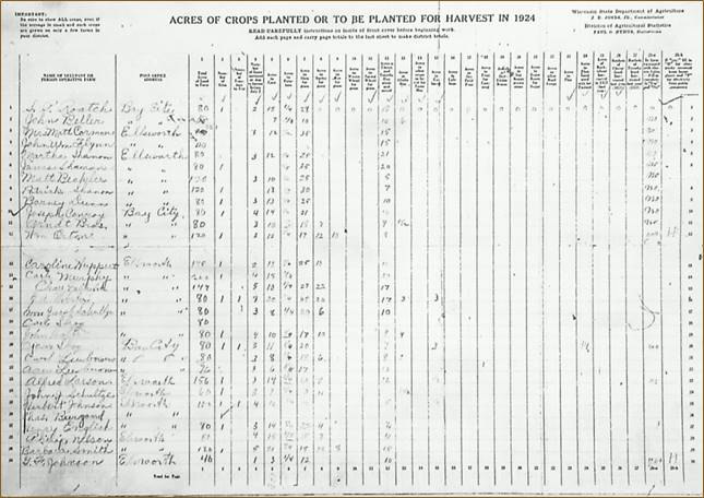
- Annual Enumeration of Farm Statistics
- Like an annual census of farmers and their farms; on microfilm
- Burnett County, 1923-1960
- Pierce County, 1923-1960
- Polk County, 1924-1960
- Saint Croix County, 1924-1956
Manuscript Collections
Personal/business/organizational papers and records.
- Burnett County
- Edward L. Peet Papers, 1859-1929 (River Falls Mss BV)
(Peet was a land developer and promoter of immigration to the cutover lands of northern Wisconsin. The collection also includes records relating to the Kohler-Peet Company, a firm dealing in land along the St. Crox and Clam rivers.)
- Edward L. Peet Papers, 1859-1929 (River Falls Mss BV)
- Pierce County
- George W. Cairns, Pierce County Register of Deeds, some papers from 1855-1873, in the Gertrude M. Cairns Papers, 1845-1959 (River Falls Mss I)
- Fred D. Lord Correspondence, 1893-1896 (River Falls Mss AH)
- Polk County
- Baker Land and Title Company (Saint Croix Falls) Records, 1879-1958 (River Falls Mss AZ)
- William M. Blanding Papers, 1847-1958 (River Falls Mss X)
- Saint Croix County
- Baker Land and Title Company (Saint Croix Falls) Records, 1879-1958 (River Falls Mss AZ)
- William M. Blanding Papers, 1847-1958 (River Falls Mss X)
- Edward L. Peet Papers, 1859-1929 (River Falls Mss BV)
(Peet was a land developer and promoter of immigration to the cutover lands of northern Wisconsin. The collection also includes records relating to the Kohler-Peet Company, a firm dealing in land along the St. Crox and Clam rivers.) - Leonard G. Rowe, Studies, 1964 and 1965. (River Falls SC 110)
(Two papers, written by Rowe: "A Historical Geography of a 'Partnership Region'" concerning the Hersey, Staples lumbering company operations in St. Croix County, and "A Study of a Rural Anomaly ...,' Century Farms.")
Plat Maps/Land Ownership Maps and Atlases
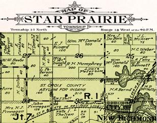
Wisconsin land ownership maps and atlases—often referred to as plat maps—identify local landowners in a county and provide information about the county's topographic and cultural features. Township maps show the boundaries and acreage of farms, locations of churches, cemeteries, schools, quarries, cheese factories, and other businesses. The township maps also show roads and railways, and topographical features such as rivers, lakes, marshlands, and hills.
Learn more about land ownership maps on the Wisconsin Historical Society's website. For digitized maps and atlases available online, follow the links for Wisconsin or Minnesota.
For hard-copy plat maps/atlases available in the UWRF Archives, consult the lists below for available dates.
County |
Years Available in the UWRF Archives |
|---|---|
|
Burnett |
1915, 1930, 1931, 1948, 1962, 1965, 1974, 1976, 1981, 1983, 1991, 1997, 2006, 2010, 2013 |
|
Pierce |
1877-1878, 1895, 1908, 1917, 1922, 1930, 1941, 1949, 1955, 1959, 1960, 1965, 1968, 1971, 1973, 1975, 1978, 1981, 1984, 1989, 1992, 1999, 2006, 2010, 2013 |
|
Polk |
1887, 1914, 1924, 1931, ca. 1940, 1950, 1962, 1966, 1969, 1972, 1980, 1986, 1989, 1992, 1996, 2000, 2007, 2010 |
|
Saint Croix |
1876, 1886, 1897*, 1914, 1925, 1929, 1938, 1949, 1956, 1959, 1961, 1965, 1968, 1972, 1974, 1976, 1979, 1982, 1985, 1987, 1988, 1991, 1993, 2005, 2008, 2010 |
* For digital copies of Baldwin (Town of and Village of), Hammond, and Woodville only from the 1897 plat book, see the University of Wisconsin Digital Collections. Use the Search Box; a search for "Baldwin maps 1897" will find all of them. Additionally, there is a plat map of the Village of Baldwin only, ca. 1890-1899, which you can find by searching "Baldwin maps 1890." (The River Falls ARC does not have a copy of this last map.)
We also have a few plat map books for neighboring counties:
County |
Years Available in the UWRF Archives |
|---|---|
|
Barron |
2008, 2012 |
|
Dunn |
1888, 1927, 2008, 2011, 2013 |
|
Pepin |
1877, 2003, 2008, 2012 |
|
Rusk |
2007 |
|
Washburn |
2008, 2012 |
Tax and Assessment Rolls
- By township and village/city in each of the 4 counties
- Years available vary by township/village
- Every year up to 1900 (when available) and then every 5 years after (e.g., 1905, 1910, 1915) up to 1995
- Tells who the owner was and how much tax was either assessed or paid.
Links to Survey Field Notes and Plat Maps, Land Patents, etc.
- The Official Federal Land Records Site (land patents, survey plats and field notes, land status records)
- Wisconsin Public Land Survey Records (original survey field notes and plat maps, and resurvey maps)
- "Tutorial on the Public Land Survey System Descriptions" (Wisconsin Department of Natural Resources
- "Tutorial on the Public Land Survey System Descriptions" (Wisconsin Department of Natural Resources


